

Afternoon: a fairytale a "castle" and off to Trubia
-
Go to Facebook
-
Go to X
-
Go to Instagram
-
Go to TikTok
AFTERNOON: A FAIRYTALE "CASTLE" AND OFF TO TRUBIA
From Las Caldas, you can return to Oviedo along the same path in the opposite direction or by bus (line G-1, one of the stops is opposite the spa and it runs every hour).
If you want to continue walking, before leaving Las Caldas towards Caces, you will encounter a stone gateway and, beyond it, a mass of trees. This is the entrance to the Castle. It is private and not open to the public. Although it is hardly visible from the outside, its crenellated towers covered in vegetation and its ogival windows resemble the illustrations of a romantic fairytale. You will be able to see them as you take the road that borders the estate towards the river. The original building dates from the time of Alfonso II (c. 760-842), nicknamed “the Chaste”, but was destroyed in the 14th century. It then passed into the hands of the Bishopric of Oviedo and was neglected. The current construction, in the historicist style, was built in the 19th century from the ruins of the original.
Walking down the road, just a few metres on the left, there is a flat area and the public swimming pools of Las Caldas. They do not tend to be too busy and, in summer, are a good option to go bathing. Sometimes, you will also see people swimming in the river. Before crossing the bridge over the Nalón River, there is a small children’s playground on the right. On the other side of the bridge, a sign indicates access to the free catch and release fishing area.
If you would like to continue to Trubia, you can do so from Fuso de la Reina, linking the Oviedo-Fuso Green Route with the Fuso-Tuñón Route, which is more of a hiker’s route, although it is very well signposted, even with warnings in places where hikers have to share sections with vehicles.
Along the first section, you will come to the pipes that lead to the Puerto Power Station – with the sound of water among the riparian vegetation, an abundance of chestnut trees and fields with cattle – and then to the suspension bridge: a 96-metre-long footbridge over the Nalón River that sways. You are advised to cross without stopping and cyclists must also cross on foot.
The distances are short and the scenery always green with well-kept farms, making the trip worthwhile, even along the road: it is less than two kilometres from Puerto to Caces and one kilometre from the entrance of Caces to Las Caldas.
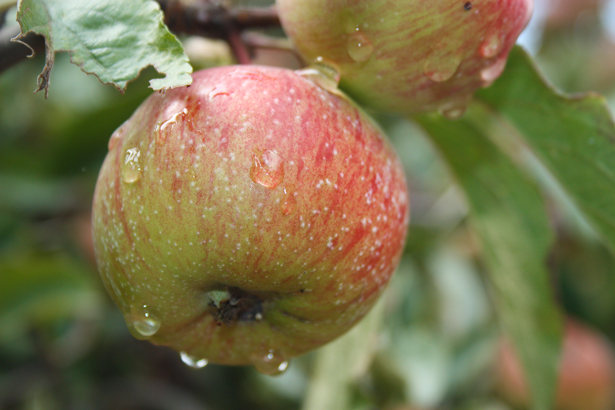
Smallholdings, "Caleyas” (Country Lanes) and Apple Groves
On your walks, you will have noticed that this is the landscape of a thousand shades of green, made up of small fields. Farms are not large in Asturias. Traditionally, smallholdings dot the countryside. The narrow lanes found in villages and between farms are called "caleyas" and if the margins are populated with brambles, they are called "escayos", where you can hopefully find tasty wild blackberries. Even more basic is to know that apple groves are called “pomaradas”. And, one more word that, although Spanish and not Asturian, is used more regularly in Asturias. “Argayo” is what we call rockfalls or landslides that affect paths and roads. But don't worry, the clearings you will find in this area have been protected and adapted, and the same can be said of the entire route within the municipality of Oviedo...
Between the Train Track and the River
The route continues after Caces. From here to the end of the municipality it will coincide with the local road in some cases but it is clearly signposted and there is a speed limit for vehicles. The path crosses the village of Caces, passes near the old schoolhouse, now a Social Centre, and continues toward Pintoria.
It is quite common to meet other hikes or cyclists as well as local people attending to their daily tasks. If you look upwards, you will see Mount Sagrandio, and, if you look down, the river. About 200 metres further on, there is a level crossing. The route now becomes completely flat and, on the left, you can see Pintoria, while, on the right, Godos Valley. Straight ahead is Mount Fansorda.
This is a hunting area; along the way, there is a riverside forest with many ash and chestnut trees, while, on the right, is a large eucalyptus tree plantation managed by a paper mill.
After a steep slope on the road, about 900 metres from Caces, the path begins to descend and enters Trubia Valley. The train track is to the left of the road, a little higher up on an old stone platform, and the river is to the right, almost at the same height as the road. It is an area of great beauty at any time of the year.
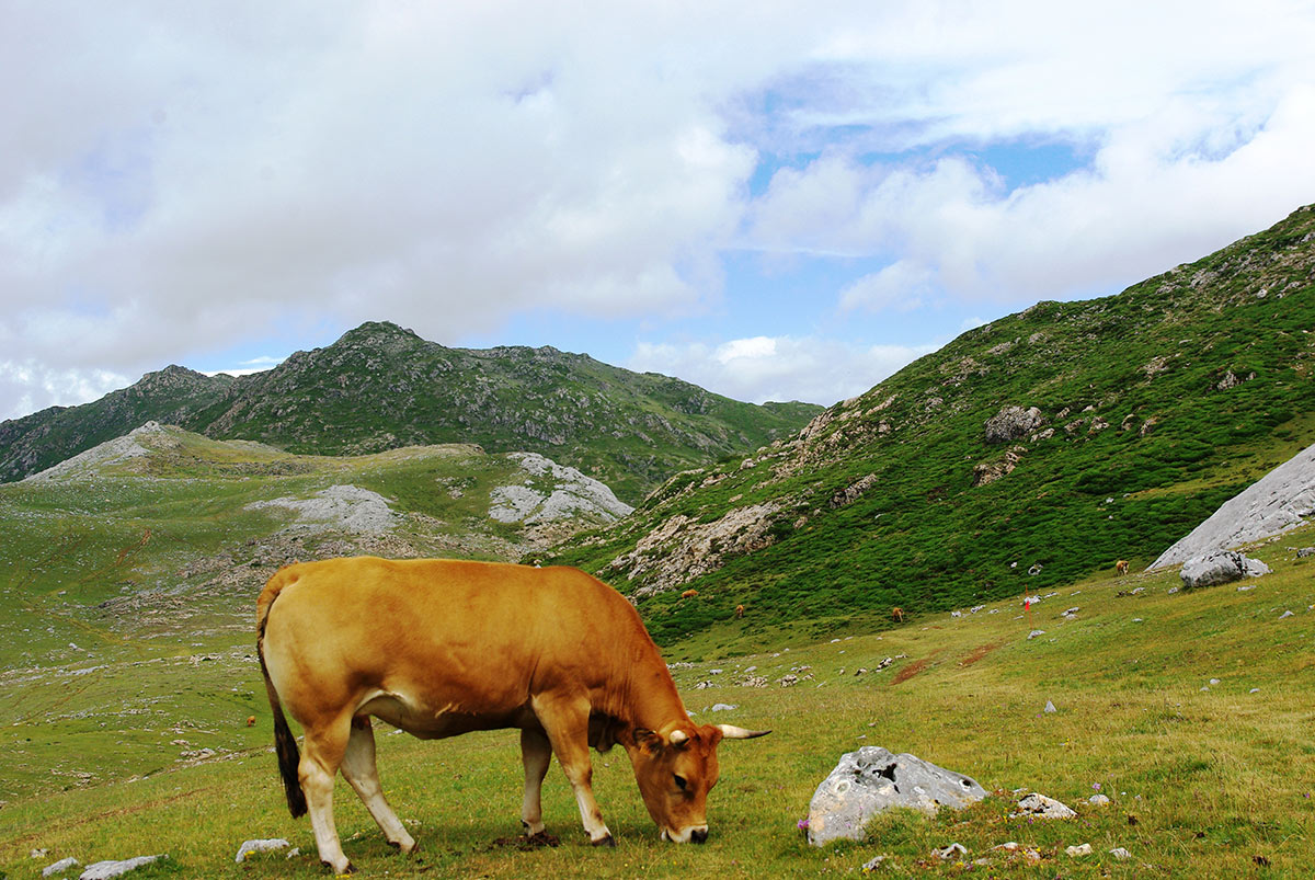
In these hills, you can find wild boar and, in the fields, “roxas” cattle.
The wild boar, which now even enter and roam around urban areas, even in family groups, with their piglets (called jabatos or rayones in Spanish), are some of the animals that are hunted in this area where there are also roe deer, foxes, partridges, and woodcock.
Speaking of animals and “praos” (fields), in this area as in all of Asturias, you will see many cows, including two recognised native breeds: The “Asturiana de los valles” (Asturian of the valleys) and the “Asturiana de montaña” (Asturian of the mountains) or “casina”, which are the only ones that produce the certified “Asturian beef”. Both are of European origin and have a chestnut coloured body, with a red brown layer that, in bable (Asturian language) is called “roxa”. The casina cattle are bred for meat - and are internationally acknowledged (World Steak Challenge) as the best in the world. They are also used to make butter thanks to their fat-rich milk. The “Asturiana de los valles” breed gives birth to very large calves and is bred for meat production, especially in the case of the culon type.
The Coal that Fell from the Train
It is a flat area of relatively large farms, with cows grazing, and the remains of what once was a large kiwi plantation. The path is flat and it is not uncommon to see ducks in the river on the right.
There is a clearly marked crossing 3.6 kilometres from Caces: keep straight on. You will see the remains of an old bridge over the river, which apparently was never finished. The locals say that there used to be a ferry crossing there because they would collect coal that fell off the trains and bring it back over the river to store or sell.
You will enter Trubia through the industrial area, leaving the houses of the old town of Nalón to the left. On the right, there is a gangway where the train from Trubia to Oviedo used to run and that, today, is only for pedestrians. The green route connects here with the end of the gangway from Soto to the factory. Opposite is Trubia Station, with a commuter train service (FEVE-www.renfe.com) and, on the left, you will access the main commercial street of Trubia, Vasco Street (a name that refers to the ancient railway system).
La “cañonera”
In Trubia, where the Trubia and Nalón rivers meet, you will find a unique example of what has been called an “industrial town” whose elements, although significantly deteriorated in some cases, still display a close relationship between the arms factory – established to produce ammunition in 1794 – and the life and society that arose around it.
As you enter Trubia, known as “la cañonera” (gunboat), behind the station and in the background, one can still see the villas of the engineers and, a bit further on, the entire working-class neighbourhood of Junigro, with four streets of terraced houses. At one end is the sports centre, formerly the farmers’ market, the worker’s casino, and then, next to the square, the music kiosk opposite today’s Healthcare Centre in a building that was once the local school based on a project by Juan Miguel de la Guardia. Right here, you will see a bridge with two cannons and, on the other side, the factory that gave rise to all this.
Another Type of Art
Trubia has a claim that is always pending, that of a Museum that houses and displays the factory’s collection, whose great archive has already been documented. Among the items to be included in the Museum are paintings, stained glass windows, metal fittings, as well as iron and bronze sculptures, in addition to a library of about 9,000 volumes on military issues and other materials, some of which date from the 18th century.
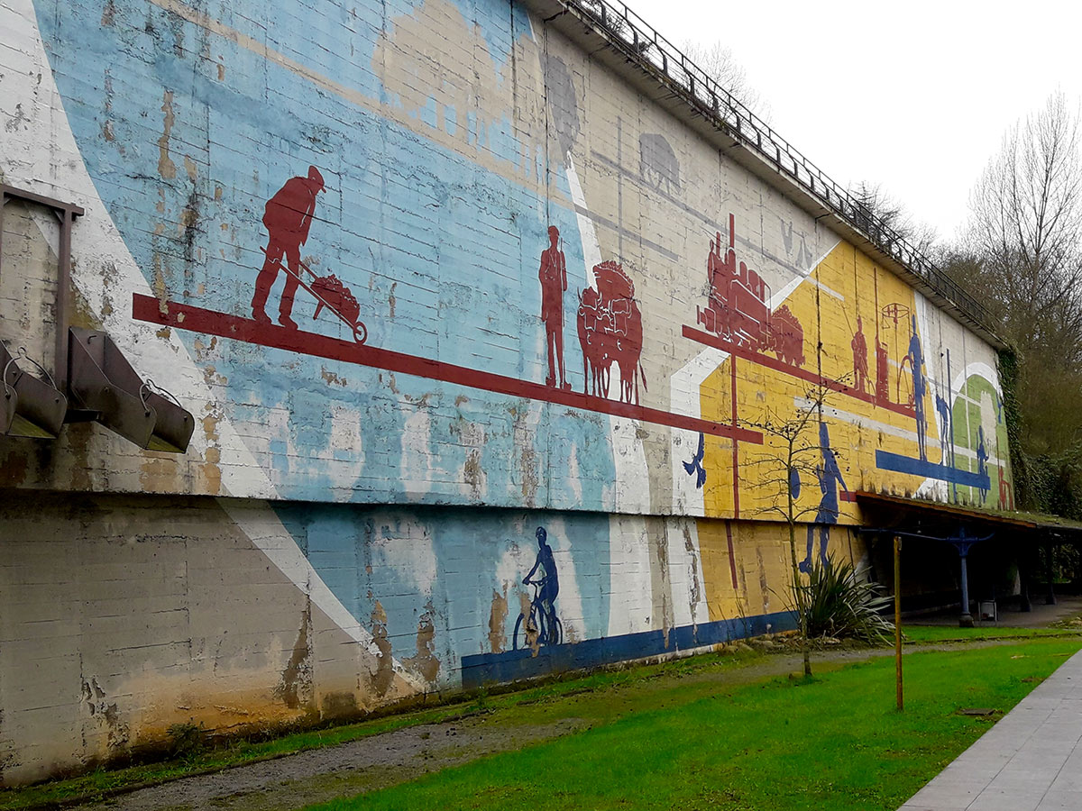
At the moment, visitors can admire another type of art related to the route in Trubia. This is a mural painted by the Asturian artist Miguel Mojardín on behalf of the construction company that erected the new housing project. The work, entitled “Trubia en tres tiempos” (Trubia in Three Parts) and somewhat spoiled by graffiti artists, dates from 2005 and is considered the largest outdoor mural painting in Asturias (70 x 12 metres). It is painted on the wall where the old coal hoppers were houses and there are some benches, right there, under a shelter of the old station.
Streets with “local” names and a 100-year-old casino
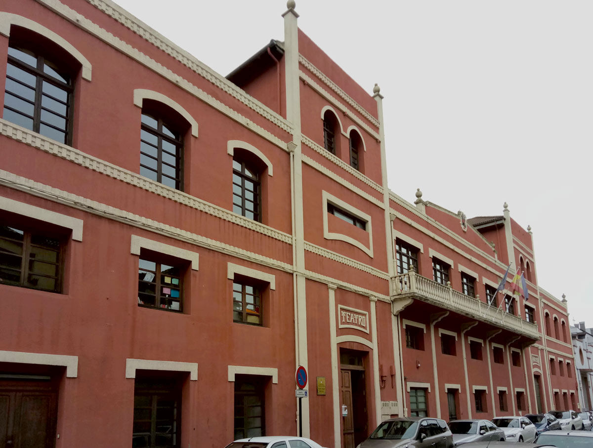
The district of Junigro was built around 1860 to house the factory workers and included forges on the ground floors. The houses are still there, but in contrast to the almost 3,000 people who lived there around 1930, there are only about 200 neighbours today. The houses are erected in parallel forming four streets and are officially named: General Cubillo, General Fonsdevila, Coronel Hernando Espinosa and General Elorza. However, locally, in Trubia, the streets are known as Monte, la Empedrada, la del Medio, and la del Río. In the latter, on the corner near the square (General Ordoñez Square) stands the casino and theatre, one hundred years old in 2018, reminiscent of a time when the town had a commissary, post office, workers’ cooperative, two newspapers, two orchestras, a choir, and an art association.
Two in One
The Trubia weapons factory, owned by the Ministry of Defence, is still in operation. It now combines the production and staff from the two weapons factories that used to exist in Oviedo after the one in the city, the La Vega factory, near Santullano, was closed down. The Trubia factory was established in the late 18th century to supply the Spanish army, since other factories were close to the border with France. This was a good site thanks to the abundant water and coal available from the Langreo mines. The first furnace was erected in 1797, although the factory was actually built 3 years earlier. It is considered to be the oldest industrial asset in Asturias. It enjoyed an early period of splendour from 1844 under the management of General Elorza, and a second successful period during the Great War (1914-1918). Today, the Trubia Arms Factory employs 380 people. However, it also provides work for 700 outsourced workers and sub-contractors. The factory is currently building the Pizarro armoured fighting vehicle for the Spanish Army and an SV for the British Army.
In Trubia, the route continues next to the park, along Sotomayor Avenue, which you have to cross toward the bridge and continue along the pavement, with the river on the right. You are now about 6 kilometres from Caces and about 9 kilometres from Fuso. If it is time to get your strength back, Trubia has excellent bars, restaurants and cider houses. And if you prefer to return to the centre of Oviedo by public transport, there are several bus stops on the road where the factory is located (Line L1).
In the End, a “Potro” (Shoeing Stock)
The route continues close to the river – which is a free catch and release area – and you will eventually reach Cataluña Park, in the French style, with parterres and benches, where you can rest in the shade of many trees. The Real Juvencia football field is on the left and, behind it is another working-class neighbourhood, Corea, although the surroundings are entirely rural.
The route now heads toward San Andrés along a narrow road that is also used by vehicles. The villages of El Villar and Las Cuestas are on the right and, straight ahead, you will see Mount Guanga, behind which are the waterfalls of the same name; however, if you want to visit them, you must take a different route. San Andres is the last stop of the L-1 bus line. Next to the bus stop, there is an old washing place and fountain (dating from 1911) and, opposite, a small construction on the river, with which city dwellers will probably be unfamiliar: it is a "potro” (shoeing stock), the place where the farmers tended to and cleaned the hooves of their livestock.